Maps & Location

◆ I-84 Exit 234 · Meacham, Oregon ◆

Finding Westminster Woods

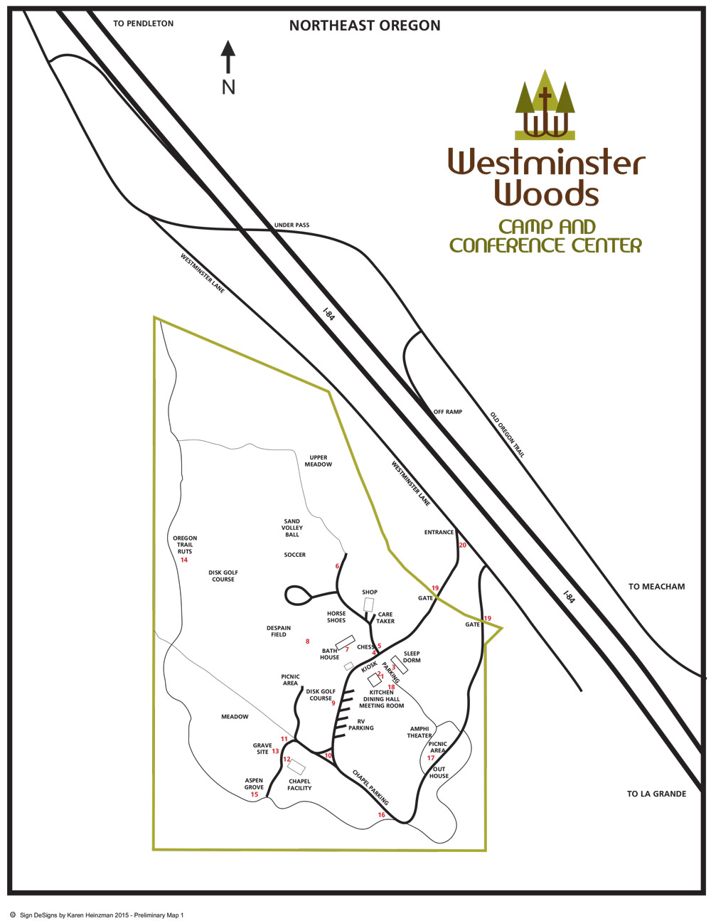
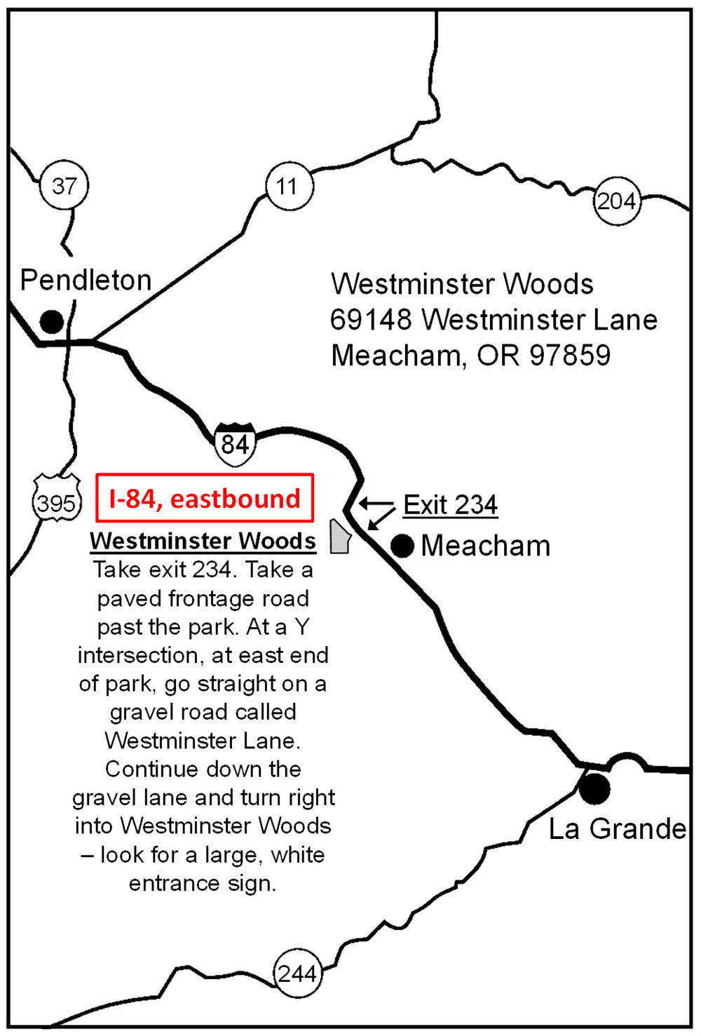
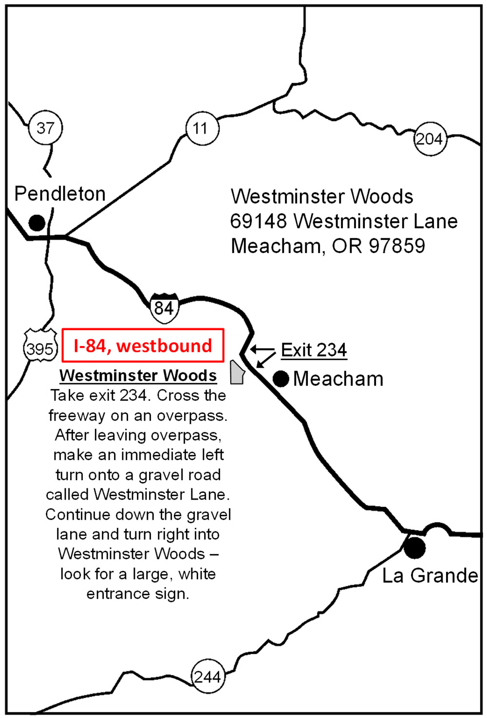
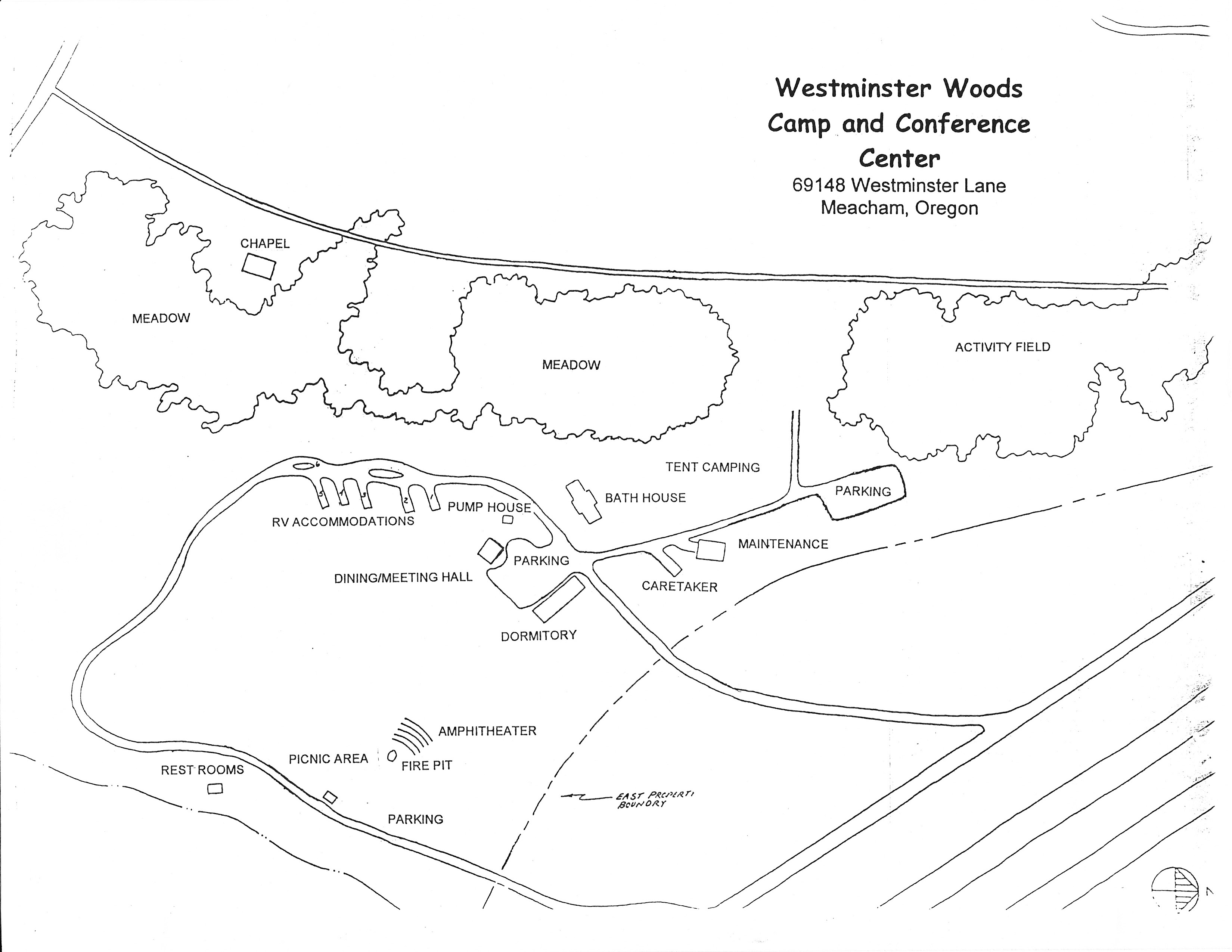
Westminster Woods is located near Meacham, Oregon in the Blue Mountains of northeast Oregon — about 25 miles east of Pendleton and a similar distance west of La Grande. The camp is easily accessed from Interstate 84 at Exit 234 (Meacham/Emigrant Springs).

The camp is adjacent to Emigrant Springs State Heritage Area, with state park lands bordering the property on three sides. Once you exit the freeway, Westminster Woods is just a short drive to 69148 Westminster Lane.

Address:
69148 Westminster Lane
Meacham, OR 97859

GPS Coordinates:
45.3340° N, 118.4140° W

Phone: (541) 276-7681
Email: westminsterintheblues@gmail.com

Westminster Woods — regional location

Freeway Access & Driving Directions

Westminster Woods is accessed from I-84 at Exit 234. The exit configuration differs depending on your direction of travel, so we’ve provided separate maps for eastbound and westbound approaches.

Eastbound

From Pendleton

Eastbound access from I-84

I-84 Exit 234

Take Exit 234 (Meacham / Emigrant Springs) from I-84. Follow the signs to Westminster Lane and the Westminster Woods entrance.

From Pendleton:
~25 miles east
Approx. 25 minutes

From La Grande:
~25 miles west
Approx. 25 minutes

Westbound

From La Grande

Westbound access from I-84

Camp Property Map

This map shows the layout of Westminster Woods, including all buildings, RV sites, trails, fields, and points of interest across the 231-acre property.

Westminster Woods property map

Download Our Brochure

Our brochure includes an overview of Westminster Woods facilities, activities, maps, and contact information — everything you need to plan your visit.

Ready to Plan Your Visit?

Open May 15 – October 15. The camp is available for rent to nonprofit groups, family gatherings, business meetings, weddings, and other special events. Everything is managed on a space-available basis, so reach out early to secure your dates.